Energy Mix
2021 · TJ- Renewable68,95175%
- Non-renewable22,40625%

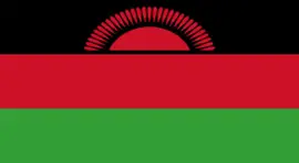
Country overview
Malawi is a long, landlocked country bordered by Tanzania to the north, Lake Malawi to the east, Mozambique to the east and south, and Zambia to the northwest. It covers an area of over 118,000 km², about one-fifth of which is Lake Malawi. Malawi stretches about 840 km (520 miles) from north to south and varies in width from 10 to 160 km (5 to 100 miles). Its landscape can be divided into four main regions: the Great Rift Valley, the central plateaus, the highlands and isolated mountains. The plateaus cover about three-quarters of the land area. The Northern Region is mainly mountainous and includes the Nyika Plateau. The Central Region, on the plateau, is the main agricultural area. The Southern Region is mostly low-lying, apart from the Zomba Plateau and the Mulanje Massif.
21,104,482
14.9%
Jump into the platform that matches what you need.
Stay informed
The best of ISA sent straight to your inbox.